
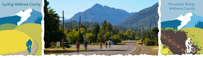
Bicycling
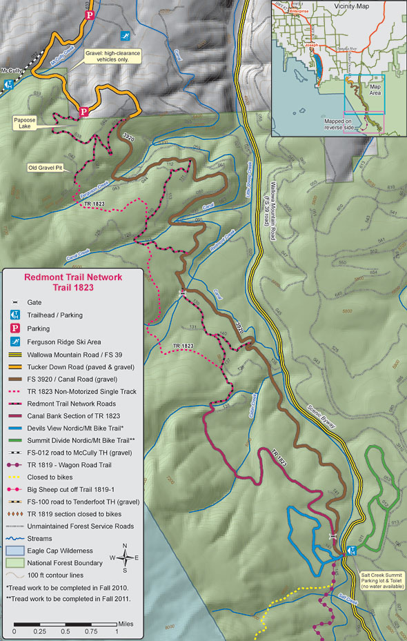
Redmont Trail and Wagon Road Complex
About the Routes:
The Redmont and Wagon Road Trail Network: The trails lie mostly within the Wallowa-Whitman National Forest; the northern end of the Redmont Trail intersects sections of private land. All routes travel through forested terrain, with several breaks that reveal wonderful views of the Wallowa and Seven Devils mountain ranges.
Trails are marked with blue diamonds, road number signs, and trail number signs. Riding season is typically mid-June to the end of October, depending on snow coverage. Annual trail clearing is usually completed by early July. All trails are multi-use; non single-track trails include motorized use.
Trailheads
Ferguson Ridge Snow Park (north end): 14 miles from Joseph. High clearance vehicles only after turn-off to McCully trailhead. No facilities; nearest toilet is at McCully trailhead.
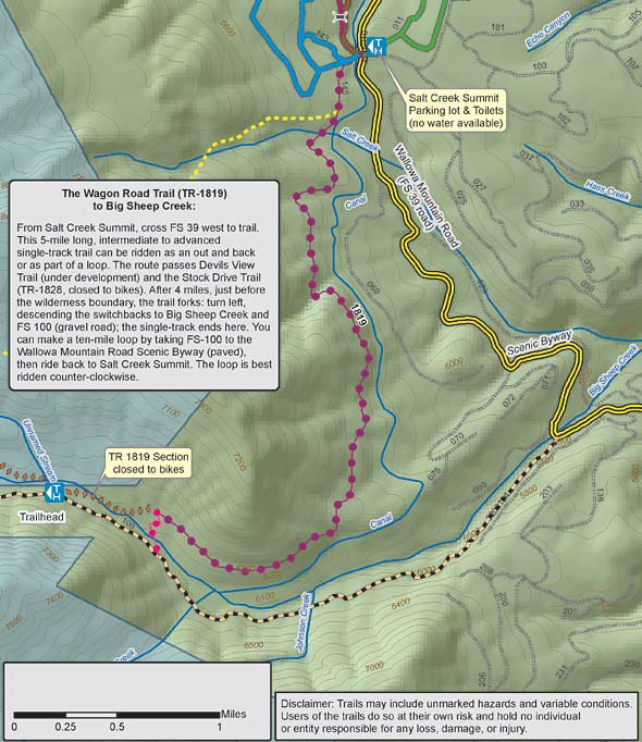
Salt Creek Summit (south end): 19 miles from Joseph Facilities include pit toilets and sheltered public building; no water.
Single-Track Trails
The Wagon Road Trail (TR-1819) to Big Sheep Creek: From Salt Creek Summit, cross FS 39 west to trail. This 5-mile long, intermediate to advanced single-track trail can be ridden as an out and back or as part of a loop. The route passes Devils View Trail (under development) and the Stock Drive Trail (TR-1828, closed to bikes). After 4 miles, just before the wilderness boundary, the trail forks: turn left, descending the switchbacks to Big Sheep Creek and FS 100 (gravel road); the single-track ends here. You can make a ten-mile loop by taking FS-100 to the Wallowa Mountain Road Scenic Byway (paved), then ride back to Salt Creek Summit. The loop is best ridden counter-clockwise.
Redmont Trail (TR 1823) Network The Redmont Trail Network offers the region's best single-track trails, and includes routes suitable for beginners as well as advanced riders. The Network's north trailhead lies just past the Ferguson Ridge Snow Park; the south trailhead lies at Salt Creek Summit. Choose between several loops ranging from 7 to 20 miles or more, or ride from one end of the trail to the other, approximately 10 miles (shuttle required). In general, the more advanced riding lies in the north section, intermediate trails inthe middle section, and mostly flat, beginner terrainin the south section of the Network. The Canal Road (FS 3920) offers beginner terrain throughout the Network, which enables groups of varying abilities to reconnect frequently during their ride. The single-track portions can be narrow and brushy, but are not particularly steep or technical. All other sections are dirt or gravel roads with varying degrees of maintenance. Many of these roads allow motorized use.
This map was created in cooperation with Northeast Oregon Economic Development District, Wallowa Resources, Wallowa County Chamber, Wallowa County GIS, Pacific Power, and the Eagle Cap Nordic Club. Trail clearing and maintenance provided by: Eagle Cap Nordic Club, Wallowa-Whitman National Forest Fire and Recreation Departments, Wallowa County Youth crews, Eastern Oregon Equestrian Club, and volunteers from Cycle Oregon and IMBA.